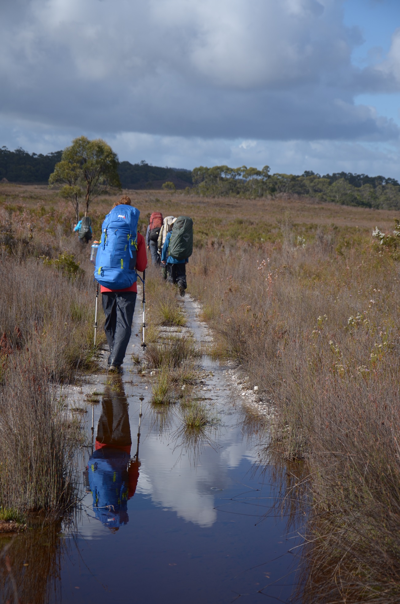

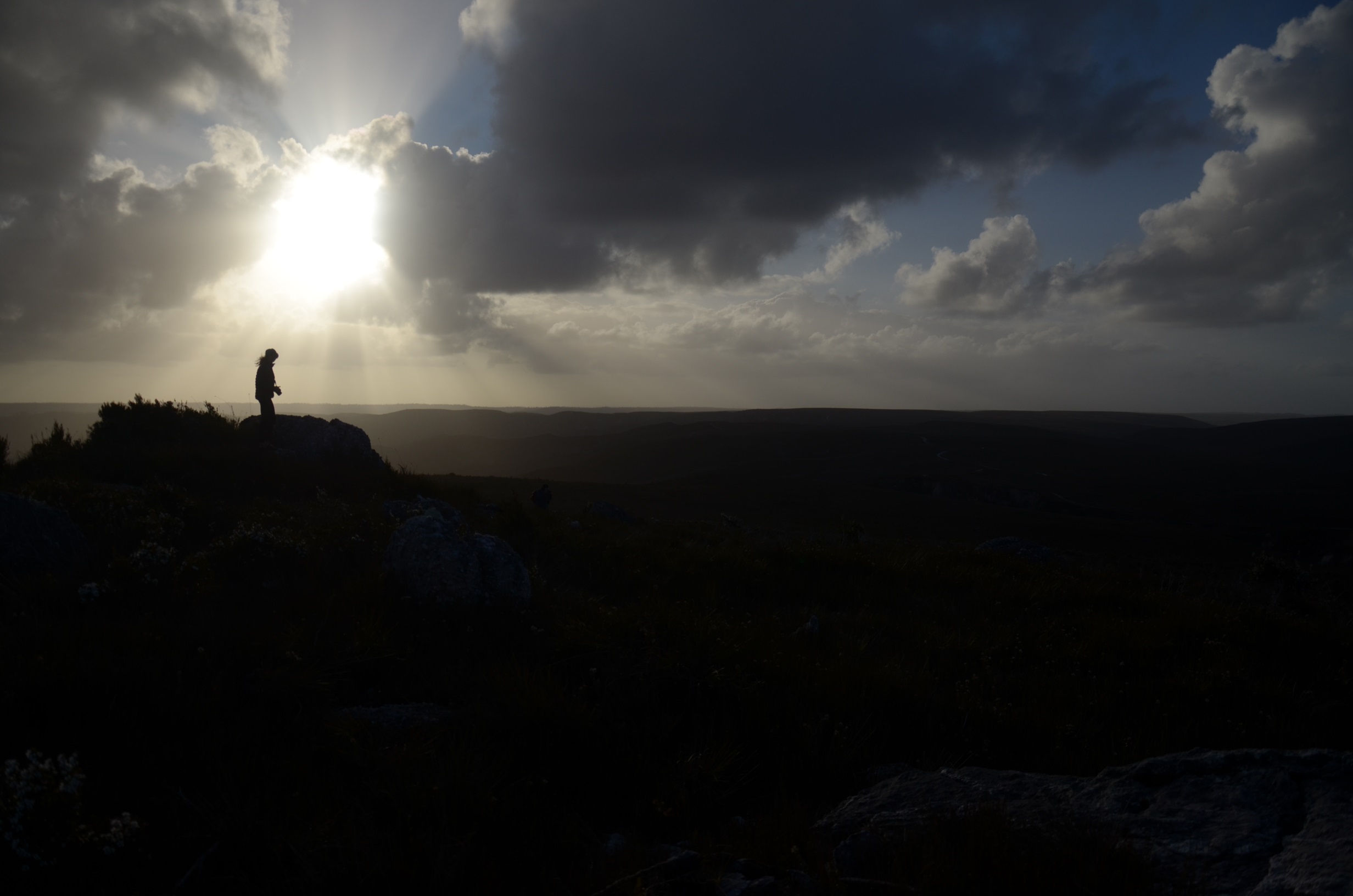
Seven of us walked across the heath, through the sort of morning glow that makes you feel like you’re doing something intrepid. The scene was fit for cinema: the seven of us were on a heroic quest. The plains were gilded, the twigs of shrubs crackled beneath our bootsoles and birdsong sparkled from branches in the gully below.
Sometimes in south-western Tasmania, the epic act is simply getting out of your tent. We had not long been liberated from a boggy, sloping campsite, where bad weather had pinned us down. A week was allotted to us; it was now Day Five. At last, we traipsed towards our destination. Having been tent-bound, it was time to scrub-bash down to the Conder River.
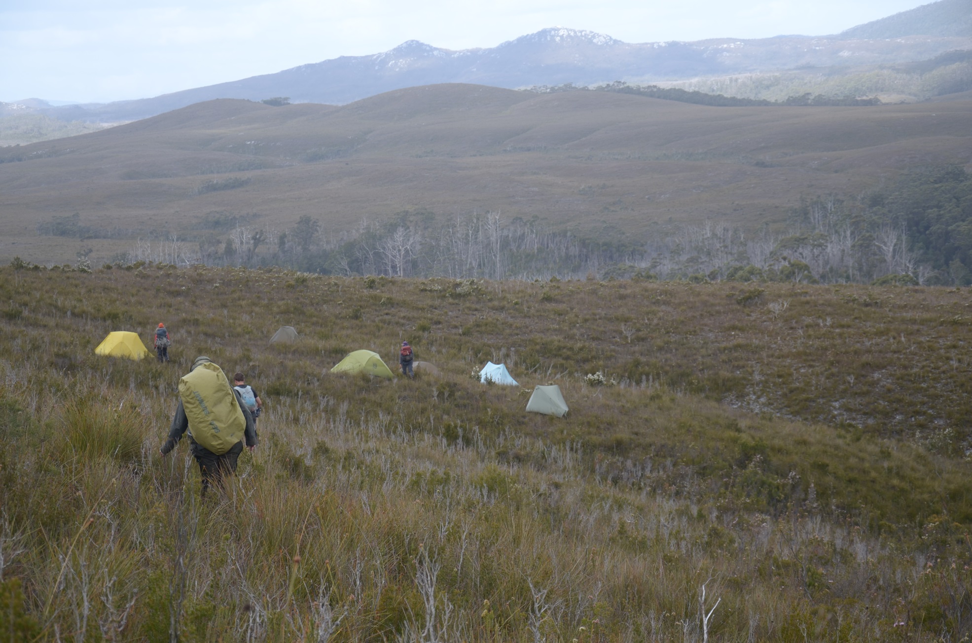
photographer BERT SPINKS
We had come to explore the Southwest Conservation Area, a corner of Tasmania that has long piqued my curiosity. Looking at it on a map, it’s a wedge of land that follows the coastline between Macquarie and Bathurst harbours, surrounded on most sides by the Tasmanian Wilderness World Heritage Area. At about 138,000 hectares, it’s somehow easily overlooked – or so it seems when you notice its omission from either World Heritage listing or national park status.
The Southwest Conservation Area was nearly added to the World Heritage Area when the matter was discussed in the late 1980s, but Tasmania’s mining concerns quashed the proposal. The potential worth of ore has outweighed the ongoing reality of the region’s mosaic of valuable habitats.
Voices calling for better protection of the Spero-Wanderer region include the Tasmanian National Parks Association and the Wilderness Society. A document produced by these two organisations call it an “incongruous exclusion” from higher levels of protection and say that it has only been spared major damage because it is difficult to access. They write, “This important part of Tasmania’s south-west has been protected from major developments not by its conservation status, but by its remoteness.”
The term “conservation area” is a little misleading in that it does not prohibit the industrial activities that threaten the special ecosystems under the title. Much of the conservation work is achieved by volunteers. Marine debris clean-up groups sometimes reach these coastlines; cohorts of devoted weed-pullers have made a huge dent on the sea spurge that has invaded its beaches. (Fore mor about that, see Helena Gjone’s feature article in Issue 113 of Forty South Tasmania).
Likewise, over the past few years, citizen science expeditions – supported by the Wilderness Society – have contributed to our knowledge of ecosystems in the south-west. It was one of these that I had joined in December 2025.
. . .
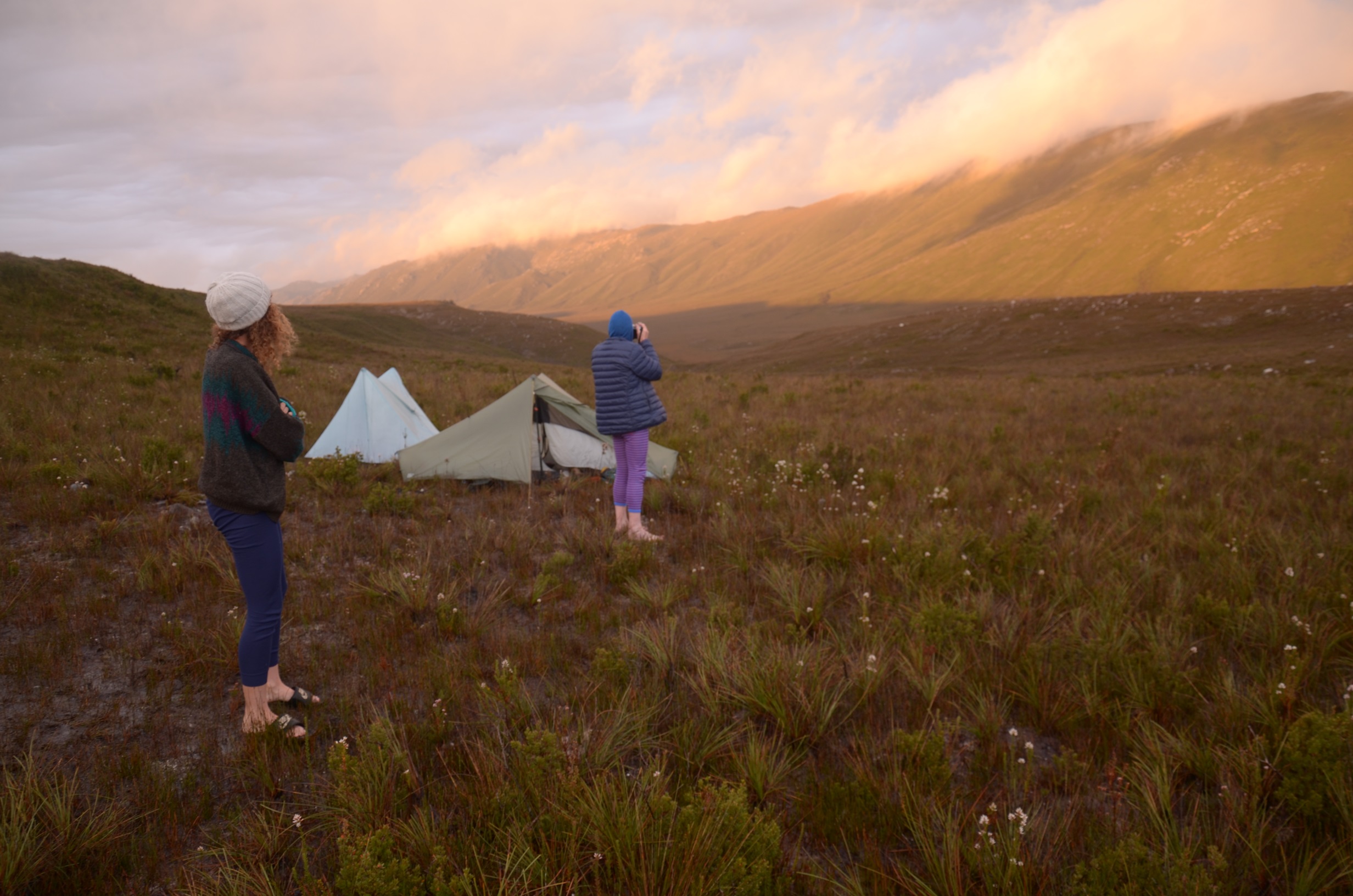
Modernity is scored into the buttongrass plains of the Southwest Conservation Area: two long strips of sand and bare stone form the rough vehicular road of the Low Rocky Point Track. Our party used this trail to access the tremendous south-west hinterland.
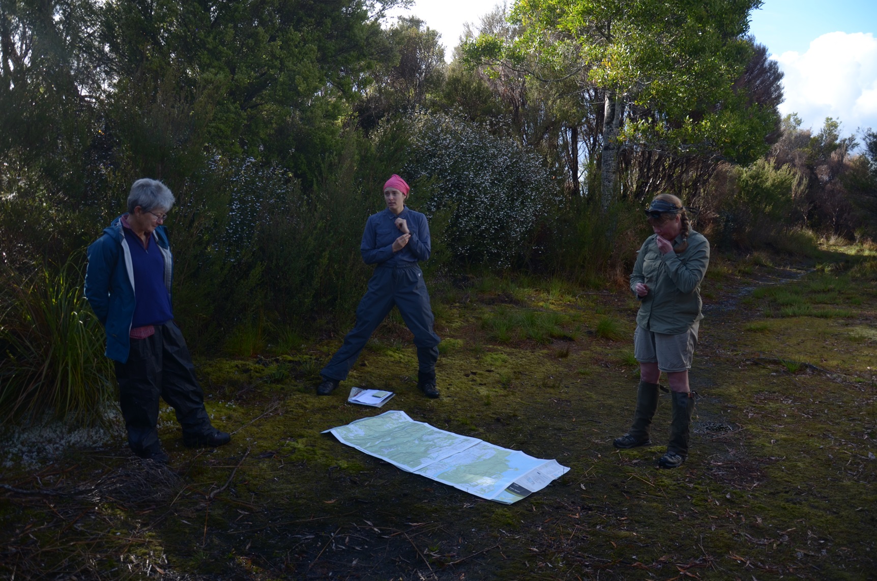
The week’s forecast was a mosaic of storms and the first warm days of summer. So much was in flower that it looked like a paintbox had been spilled. Birds intermittently flitted throughout our midst: pipits, tree martins, striated field wrens. An array of orchids flourished: sun orchids, beard orchids, leek orchids. Each was recorded, data to be later uploaded onto interactive maps online.
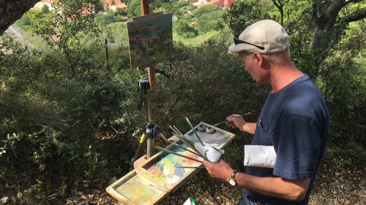
I have worked as a guide, and banged on plenty about Tasmanian landscapes, but I was still overwhelmed by the knowledge in our group. Latin names were bandied about without mercy; plant anatomy was astutely pointed out. My fellow citizens were not only knowledgeable with botany, most were great photographers.
It was easy to feel like a hanger-on, but I may have made the trip’s most unexpected discovery. Late on the second day, as the cold rain began to blow in from the Southern Ocean and we began trudging with leaden footsteps, I heard high-pitched squeaking from beneath a tussock. Though the calls were a bit unusual, I thought that it might be a small flock of ground parrots – those rare wonders, furtive emerald feather-balls that frequent the buttongrass plains but are found in few other ecosystems. Instead, I found a litter of feral kittens. The mum had bounded off across the moor, but her newly-born offspring lay there, wet and writhing and calling plaintively from their bed beneath the buttongrass.
. . .
A larger expedition traversed the moor in autumn 1833 – a party of 24 people led by George Augustus Robinson on his mission to negotiate with the different nations around the island. The majority of this group, in fact, were Aboriginal Tasmanians.
Robinson was not a trained naturalist but his observations are sometimes still relevant, two centuries later. “The travelling is excellent provided the traveller avoid the middle of the swamp,” he journalled on May 11. The next day he complained about a common species of alga, “Have observed that all the mountains and hills in this country are covered with this slimy substance whilst the western and north-west side clear from it. This is owing to the heavy rains which beat against it and clear it away.”
When a boisterous nor’westerly system arrested our progress, we camped in the lee of a ridge – that is, on its eastern side. I can report that the ground there is still unctuous with the “slimy substance” that Robinson’s historic mission encountered.
Robinson understood that this was the country of a nation known as the “Lowren” or “Lowrenee”. The 14 Aboriginal people who accompanied his trek were from other parts of the island, but they related to their surrounds in a way that the colonists contingent did not. They caught native fish from the rivers and hunted marsupials across the plains.
When the hunters returned to camp with three wombats, Robinson ordered a convict servant to cook up “a stew of the hind quarter of this animal … which is excellent food, especially with onions, potatoes, pepper and salt”. It is natural history of a kind.
Meanwhile, Robinson’s quest continued: he was in pursuit of the Lowrenee, hoping to convince them to leave their homelands in the face of colonial violence. He may have told them that it was only for the time being, but in truth the exile was permanent.
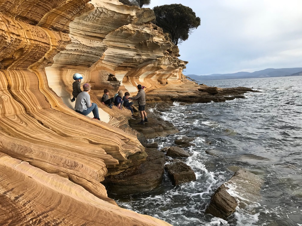
I may never cease to wonder at the fact that although nobody nowadays lives in south-western Tasmania, it was well-populated when the British arrived. Along the coastline of the conservation area, old campsites speak to the long human history of this now little-known region.
. . .
Following the dispossession of the Lowrenee and their neighbours, this part of the island received little attention. But in the late summer of 1879, an indefatigable bushman named TB Moore undertook a huge mission into the area. He went on his own initiative, with no support apart from his two dogs. Their names were Spero and Wanderer.
As well as naming landmarks, he burnt the country as he went, likely for the first time in nearly half a century. It’s hard to know what he might have torched. Among the many talents of TB Moore, he was a skilled botanist – a citizen scientist before the term had been coined. But the main purpose of his south-west expedition was to inform the burgeoning mining industry.
The garishly-coloured geology charts explain why this area isn’t included in the World Heritage listing. As was proven by TB Moore and his contemporaries, much of western Tasmania is highly mineralised. For decades, mining companies have scoured this part of the south-west for precious metals. The maps show dozens of boreholes scattered around the place. A mining company built the Low Rocky Point track in the 1950s to aid surveys and bring in heavy machinery. A network of other trails has since been constructed. One geologist describes the approach as “bulldozer exploration”.
. . .
A bushwalker is often reduced to a trudge on these bulldozed tracks – on foot, they’re tough going. It was almost a relief to get off the quartzite shards and begin to tackle the welter of scrub that formed a barrier between us and the Conder River.
We might have seen a lot more of the area, but the best-laid plans often come to little in the south-west. Having been forced into tents for a full day, the suggested itinerary was whittled down. In the end, our team’s objective was simply to see the river with our own eyes and record what flora and fauna we found there.
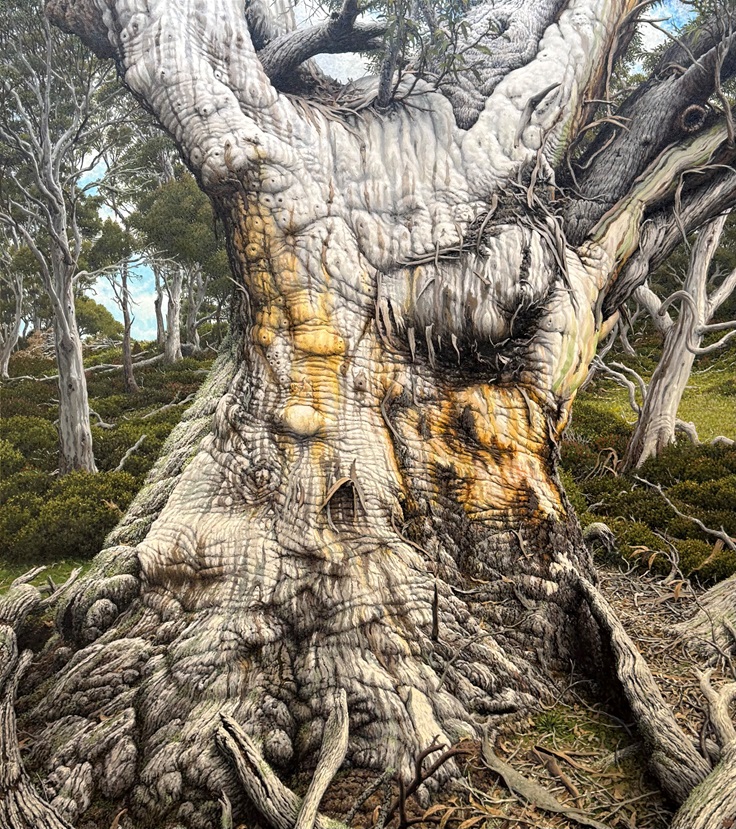
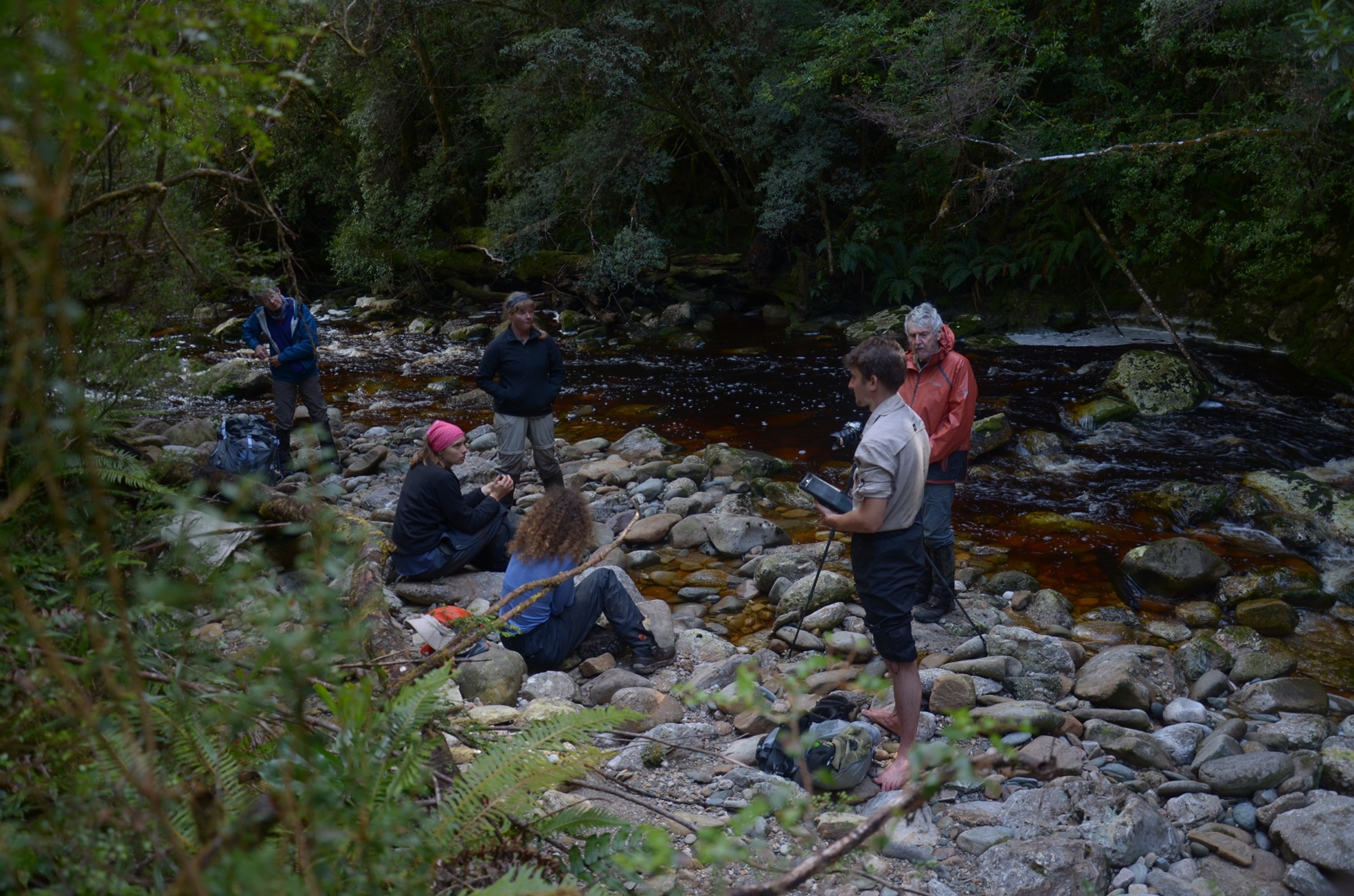
So on that fifth day, we skidded and slipped down a densely-wooded slope to where the frothed-up water flowed. Fecund rainforest fringed its course – even Robinson mentioned the “beautiful evergreens” here – and in these moist recesses, fungi and insects sheltered. Rosellas called from the treetops; crescent honeyeaters slurped nectar from crimson waratah flowers.
On an official map, the banks of the Conder were marked as a forest characterised by an abundance of huon pines. It was for these rare, slow-growing trees that we had aimed for this river, but as we bashed down through almost every other species of rainforest vegetation, it became clear that it wasn’t huon pine habitat.
I had no qualms about finding native laurel, myrtle, leatherwood and sassafras instead. As was discussed amongst our group, the absence of these trees was also useful data. In a bushfire, resources set aside for the protection of threatened species can go somewhere else, secure in the knowledge that – on that particular stretch of the Conder – none of us saw a single huon pine.
. . .
For a couple of hours, we lingered in the rainforest, looking for other living beings. I’d have been happy to stay there for days, but we had a long return journey ahead of us.
A tiny spider – precious and possibly unknown to science – scuttled out of the shingle and beyond the reach of my dicky old camera’s lens. I ponder that spider as I unfold my large-scale map of the south-west. I won’t be able to look at these features again without my eye getting snagged on certain features. Even the algae-slick campsite at which we were stuck for longer than we’d planned will forever strike a personal chord.
So much happens in Tasmania that it can be hard to keep up with it. Summer fires, tourism proposals, logging and mining leases can all threaten habitat. Among the general populace, major dramas can go unnoticed. But it’s hard to miss the news when a place-name brings back immediate memories, a precise, three-dimensional image of what exists there.
Our task in the south-west was talked about as “ground-truthing”, which is exactly what I got from the experience. I can now think of the country of the Southwest Conservation Area, recalling it down to particular patches. I flex my memory to see where crouched over a sun orchid with my hand lens or saw a moth settled on a blade of sedge. If I look closely, I can see a long bootprint streaking through a layer of slime.
“If mines went ahead, however, the area’s wilderness values would be blighted by roads, ports, settlements and pits,” environmentalists postulate. This would not merely mean distant blots on a map, for me. Now, in my mind’s eye, I would see the complex of species that co-exist in that vast acreage of our remote country.