
Anne is a complex soul. Beautiful, popular and flirtatious, she is also volatile – capable of rapid mood swings from serene and welcoming to angry and aggressive. Towering over her peers, she represents the highest point in Southwest National Park and has long been an object of desire for bushwalkers, climbers and photographers.
photographers ROB SHAW and SCOTT GELSTON
At 1,423 metres, she sits 27th among the 158 Abels, Tasmania’s mountains above 1,100m, but Mount Anne does not give of herself freely. Initial suitors were repeatedly spurned. One, named Giblin, courted her three times and, in 1922, came within 10m of his quest only to be rejected.
Anyone attempting to get close to this geological matriarch is not short on warnings. The relevant Tasmap says “The Mount Anne Track is a serious undertaking”, adding that the “final summit requires good scrambling skills”. John Chapman’s South West Tasmania adds, “There is some steep scrambling … the circuit is recommended to bushwalkers with some previous off-track experience … all groups visiting this area should be prepared for cold, wet conditions.” The Abels, by Bill Wilkinson, details the “fairly severe exposure” and Anne’s “list of potential dangers”. A Parks and Wildlife information board at the base of the mountain says, “The track may be affected by severe and unpredictable weather which poses a serious threat to personal safety … extreme winds are common and can pose a serious threat as large sections of this track are extremely exposed and offer little protection … the circuit has been the site of a number of rescues and fatalities.” If that is not blunt enough, it goes on, “Failure to make good decisions when in South-West Tasmania can lead to serious injury or death.” It concludes, “Continuing beyond your limits may result in injury or death.”
Another sign near the emergency hut at High Camp features a flat hand in a red octagon and the words, “Turn around here – risk of injury or death.” They’re not sugar-coating this. The “injury or death” phrase gets plenty of air time.
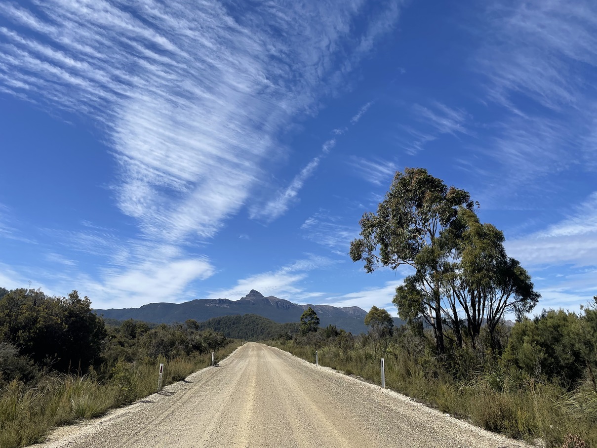
However, providing all these warnings are heeded, sensible precautions are taken, and the weather stays acquiescent, Anne can be a most agreeable host. Located just east of Scotts Peak Road overlooking the flooded Lake Pedder, Mount Anne dominates her vicinity. Named in 1835 after the wife of Surveyor-General George Frankland and not conquered until Christmas Day 1929, Anne is part of a small range of quartzite peaks capped by red dolerite. She is the focal point of a three-day circuit, overshadowing sibling Abels Mount Lot (1,262m) and Mount Sarah Jane (1,290m), both impressive mountains in their own right and higher than anything in either the Western or Eastern Arthurs situated a short distance away to the south.
Along with hiking companions Scott Gelston and my cousin’s son Martin Hulcoop, we set out with grand plans of completing the 22km circuit with extra days on our agenda to explore several additional highlights, not least Tasmania’s rarely-visited highest waterfall. Tackled clockwise, the circuit begins with a 700m climb over the 3.6km from the beginning, at Condominium Creek, to High Camp, nestled at the base of the final steep scramble up Mount Eliza. It is a fitting welcome to the range – hard work but made easier by the consistent gradient and a well-maintained, stepped track. Just short of the 1km contour, but still within the tree line,
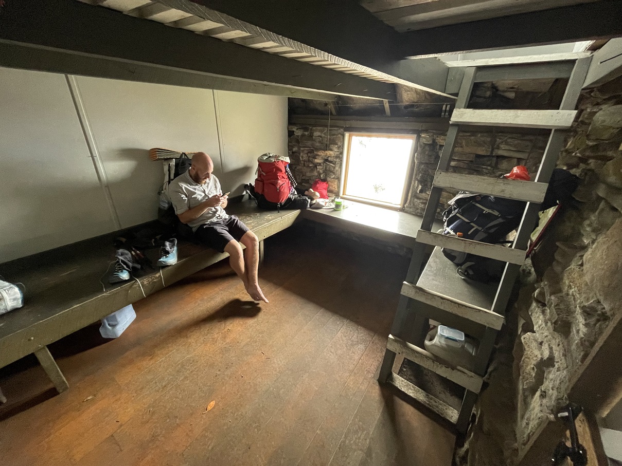
High Camp features several surprisingly-sheltered tent sites plus an emergency hut, built in 1974 in memory of three Hobart Walking Club members including pioneering wilderness photographer Olegas Truchanas. A two-storey stone structure, complete with fresh water tank and nearby toilet, the hut provides a welcoming rendezvous spot for assorted parties destined for higher altitudes. Having already driven from Launceston, we reached it in the early afternoon and, with dubious weather forecast, opted against a summit assault in favour of staying at High Camp for our first night. It was to prove a very fortunate decision.
Low cloud soon engulfed our target and, as the rounds of cards became more heated, the weather did the opposite: the temperature fell and, a little later, so did the rain. It escalated to downpour, morphed into snow, and increasing winds buffeted our refuge. Had we continued, we would have spent the night at Shelf Camp, one of the most majestic but exposed campsites in Tasmania – as windswept as it is wonderful. Tales abound of tents, and their contents, being blown away. We were delighted not to be there.
After a night of meteorological mayhem, we awoke to relative calmness, but the stubborn low cloud showing little sign of dispersing. Debating our plans, we plumped for a leisurely breakfast and more cards in the hut as we gave the weather gods time to consider their next move. Several coffees later, Scott returned from a toilet break with the news that the cloud was lifting and Mount Anne had made an appearance. It was 10.30am. After a brief discussion, a 3-0 vote settled on a summit assault with day packs, leaving our overnight gear at the hut. We were underway 10 minutes later.
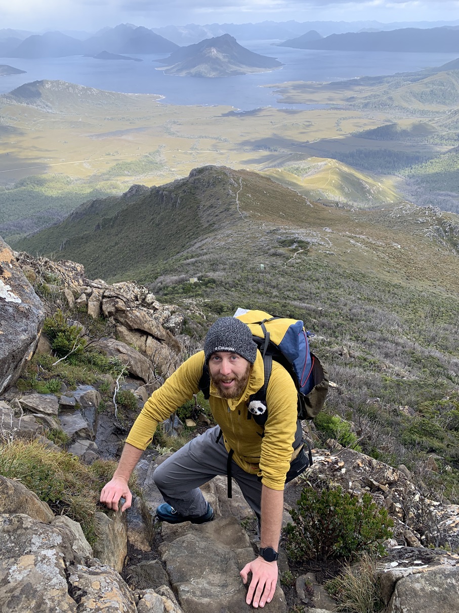
All accounts of the Mount Anne Circuit agree that the most dangerous part is The Notch, a taxing climb between Shelf Camp and Mount Lot. However, the steepest prolonged section is the 500m immediately beyond the emergency shelter to the 1,289m summit of Mount Eliza. We were delighted to be tackling it without our full packs. After this was pleasant walking across the flat but exposed ridges as we encountered the traditional mix of mainland and international visitors, while one of the few fellow home-staters just happened to be the son of my sister-in-law’s best friend. How Tasmanian.
Bypassing Eliza Bluff and Eve Peak, we reached a well-cairned junction where the circuit continues east, but Anne beckoned us north. Rock scrambling across a scree field was accompanied by ever-more impressive views of our objective before we reached the base of the final climb. An arrow scratched into a vertical rock face pointed straight up and indicated a precarious and rather unnerving route through what could just about be described as a gully. Maybe it was because I had promised my cousin that of course I would look after her son, but what followed was perhaps the scariest Abel climb I have tackled. Technically demanding rock climbs accompanied off-camber slopes coated in slippery, wet lichen leaning precariously toward serious drops. By now, it was also snowing, but gloves weren’t an option as bare fingers were essential for securing hand-holds.
As a result of all this, there was none of the usual summit euphoria and relaxing sun-drenched sandwich stops. We high-fived nervously and managed a few photographs, but they captured some rather forced smiles as we all contemplated the sketchy route back down. Twenty buttock-clenching minutes later, a group hug was in order when the dangerous part of the descent was successfully completed. We retraced our steps round the circuit, briefly scouting out Shelf Camp before stumbling back into the High Camp hut eight hours after leaving it. The low cloud returned that night and chose to hang around for two more days. We didn’t.
However much planning and discussion goes into a hike, we always agree that the weather has the final say. While it denied us the full circuit, it allowed us a wonderful date with Anne, and she was as accommodating as we had hoped.